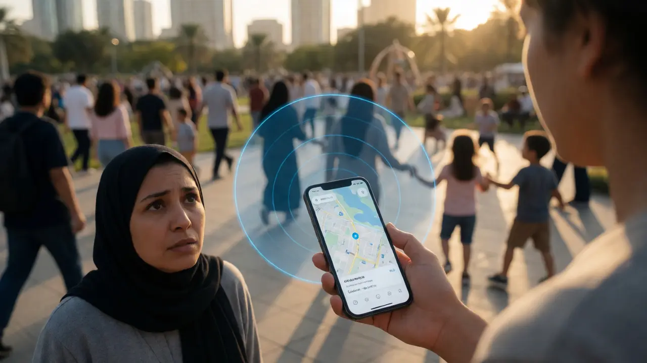
Imagine a child wanders off in a crowded park. In the old days, you’d shout their name until your voice gave out, hoping they heard you over the noise. Today, that scenario plays out differently. Your phone buzzes. An alert pops up: Amber Alert or a local missing person notification. It includes a photo, a last known location, and a specific radius. You’re not just a bystander anymore; you’re part of a digital dragnet.
This shift from physical shouting to digital precision is driven by geo-fencing. It’s not magic, but it feels like it when it works. For families searching for a loved one who hasn’t come home, understanding how these tools work isn’t just tech trivia-it’s hope with a timestamp. Let’s break down how virtual boundaries turn smartphones into search parties.
The Virtual Fence That Never Sleeps
A geo-fence is essentially a virtual perimeter around a real-world geographic area. Think of it as an invisible fence drawn on a map. When a device crosses this boundary-entering or leaving-the system triggers a pre-set action. For missing persons, this technology transforms passive location data into active intelligence.
How does it actually find someone? It relies on the constant ping of cellular towers, Wi-Fi signals, and GPS satellites. When law enforcement activates a geo-fence around a suspected area, they aren’t looking at a live video feed. They are querying databases. If a phone associated with the missing person (or phones in general, depending on privacy settings) pings within that zone during the critical time window, the system flags it. This narrows the search field from "somewhere in the city" to "within a two-mile radius."
It’s crucial to understand that geo-fencing doesn’t track individuals in real-time like a spy movie unless consent or legal warrants are involved. Instead, it filters noise. It tells investigators where not to look. That negative space is just as valuable as positive hits. If no devices pinged in Zone A, teams can redeploy resources to Zone B immediately.
From Amber Alerts to Silver Alerts: The Evolution
We all know the Amber Alert system, established in 1996 after the abduction of nine-year-old Amber Hagerman. But did you know the original system was far less sophisticated? Early versions relied on radio broadcasts and TV crawls. Today’s integration with Wireless Emergency Alerts (WEA) uses cell broadcast technology to push messages directly to compatible handsets within a defined geo-fence.
This distinction matters. WEA doesn’t require you to download an app or subscribe to a service. It bypasses the need for individual address targeting. If you are physically inside the geo-fenced polygon, you get the alert. This scalability is why these systems have saved thousands of lives. In 2023 alone, the National Center for Missing & Exploited Children reported that AMBER Alerts contributed to the safe recovery of hundreds of children.
But what about adults? The Silver Alert system targets missing elderly adults, often those with dementia or Alzheimer’s. These cases are tricky because the missing person might be confused, wandering aimlessly rather than being abducted. Geo-fencing here helps correlate movement patterns. Did the subject leave a care facility at 2 PM? The geo-fence expands outward from that point, checking for device activity along likely walking routes.

How Digital Dragnets Work in Practice
Let’s walk through a realistic scenario. A teenager goes missing after a party. The police receive a tip that he was seen near a specific shopping district. They don’t send 50 officers to comb every alleyway blindly. Instead, they set a geo-fence around the district.
- Data Collection: Telecom providers log which devices connected to towers in that zone between 8 PM and midnight.
- Filtering: Investigators filter out regular commuters and residents who were already there. They look for anomalies-devices that entered the zone but didn’t follow typical exit patterns.
- Correlation: They cross-reference this with surveillance footage timestamps. If a phone pinged near the north exit at 9:15 PM, cameras there are checked first.
- Public Broadcast: Simultaneously, a localized alert is pushed to public apps and social media platforms targeting users in that zip code.
This multi-layered approach reduces the "needle in a haystack" problem. Without geo-fencing, you’re searching the whole haystack. With it, you’re searching a single bale of hay.
Privacy vs. Urgency: The Ethical Tightrope
Here’s where it gets messy. To make geo-fencing effective for searches, we trade some privacy for safety. When you see a pop-up asking if you want to share your location with a search volunteer app, you’re opting into a voluntary network. But what about involuntary tracking?
Law enforcement access to historical location data has faced significant scrutiny since the Supreme Court’s ruling in Carpenter v. United States (2018). This case established that accessing detailed cell-site location information (CSLI) constitutes a search under the Fourth Amendment. Consequently, police generally need a warrant to pull broad location data from telecom companies, not just a subpoena.
| Method | Speed | Accuracy | Resource Cost | Privacy Impact |
|---|---|---|---|---|
| Traditional Canvassing | Slow | High (visual confirmation) | Very High | Low |
| Cell Tower Triangulation | Moderate | Moderate (GPS accuracy varies) | Moderate | High (requires warrant) |
| Volunteer App Geo-fencing | Fast | Variable (depends on user density) | Low | Voluntary Consent |
| Surveillance Cameras | Real-time | High | High (manual review) | Moderate |
For the average citizen, the concern is scope creep. Will my location data be used for minor infractions? Currently, most jurisdictions restrict geo-fence warrants to serious crimes and missing persons cases involving imminent danger. Always check your local laws, but generally, the threshold for "exigent circumstances" allows faster access during active emergencies.
Tips for Families: Maximizing Digital Chances
If you’re dealing with a missing person situation right now, don’t wait for the police to figure everything out. Here is how you can help the digital machine work for you:
- Keep Phones On: Even if the battery is dying, do not turn off the device. A powered-off phone cannot ping towers. If possible, keep it in airplane mode only if instructed by authorities to save battery while preserving connectivity features.
- Provide IMEI Numbers: Give law enforcement the International Mobile Equipment Identity (IMEI) number of the missing person’s phone. This unique identifier helps distinguish their device from others in the same household or group.
- Check Smart Devices: Did the person wear a smartwatch? Use fitness trackers? Many of these devices have independent cellular connections or Bluetooth logs that sync with cloud accounts. Accessing these logs can provide movement history even if the main phone is dead.
- Social Media Geotags: Look at the last few posts. Were they tagged with a location? Sometimes a friend’s post reveals the missing person’s last known spot more accurately than memory serves.
Also, consider joining community search groups that use dedicated apps like Find My Friends or specialized rescue platforms like Pawboost (for pets, but similar tech) or HawkEye for human tracking. These rely on crowdsourced eyes and digital pings.
The Future: AI and Predictive Geo-Fencing
We are moving beyond static fences. New algorithms analyze behavioral patterns to predict where a missing person might go. If a subject has a history of wandering toward water bodies or train stations, AI can dynamically adjust the geo-fence priority zones. This predictive modeling cuts search times significantly.
Furthermore, the integration of IoT (Internet of Things) means more sensors are logging presence. Smart streetlights, traffic cameras, and even delivery drones are becoming nodes in the search network. The future of finding the missing isn’t just about bigger nets; it’s about smarter, self-adjusting nets.
Does geo-fencing work if the phone is turned off?
Generally, no. Most standard cellular tracking requires the phone to be powered on to communicate with cell towers. However, some newer devices with ultra-wideband chips or specific 'Find My' networks may retain limited functionality via Bluetooth mesh networks, allowing other nearby Apple or Android devices to anonymously report the location even if the screen is off, provided the battery isn't completely dead.
Do I need a special app to receive missing person alerts?
No. Wireless Emergency Alerts (WEA) are built into most modern smartphones. You should receive Amber, Silver, and Blue Alerts automatically if your phone supports them and the feature is enabled in your settings. Dedicated apps offer additional details and crowd-sourcing features, but the basic government-issued alerts do not require downloads.
How accurate is geo-fencing for locating a missing person?
Accuracy depends on the technology used. GPS can be accurate within 5-10 meters outdoors. Cell tower triangulation is less precise, potentially ranging from 100 meters to several kilometers depending on tower density in urban versus rural areas. Wi-Fi positioning offers moderate accuracy indoors. Law enforcement combines these data points to create a probable zone rather than a single pinpoint coordinate.
Can police track my location without a warrant?
In urgent situations involving imminent risk of death or serious injury (exigent circumstances), police may access location data without a warrant. For non-emergency investigations, recent court rulings typically require a warrant to obtain detailed historical location data from telecommunications providers. Real-time tracking rules vary by jurisdiction.
What happens if multiple people enter the geo-fence?
The system logs all qualifying device interactions. Investigators then filter this data based on time of entry, duration of stay, and correlation with other evidence (like CCTV). The goal is to identify anomalies-devices that behave unlike the usual population of that area-rather than identifying every single person present.